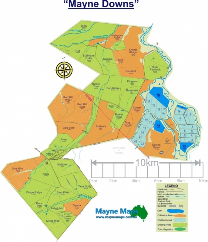
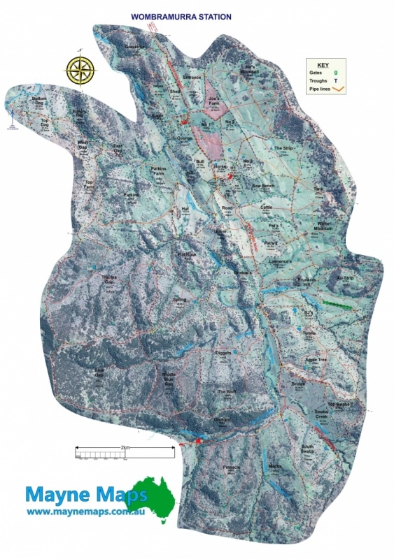
A large property map of a property near Emerald in Queensland. This is an example of a Sheep Station Map.
A macadamia orchard map
This macadamia orchard map is 3km long and packed full of macadamia trees.
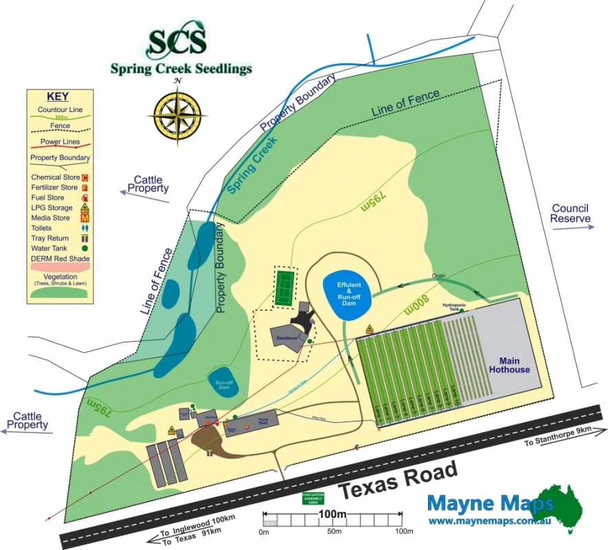
A Plant Nursery Map
Spring Creek Seedlings Map near Stanthorpe on the Granite Belt.
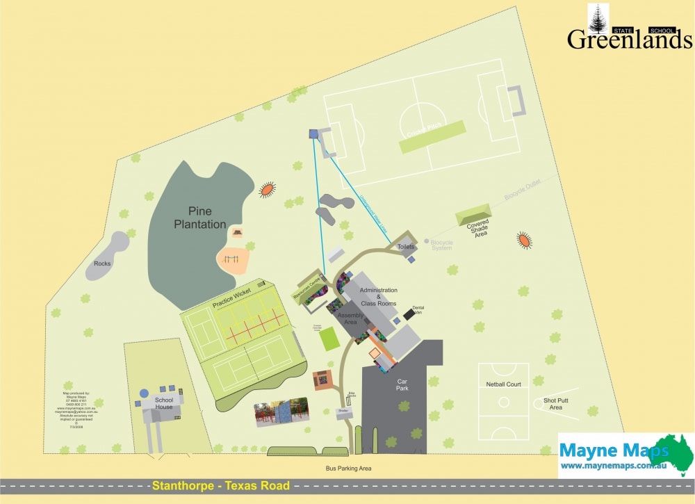
A School Map
Greenlands State School Map
A small macadamia property map
A small macadamia orchard map.
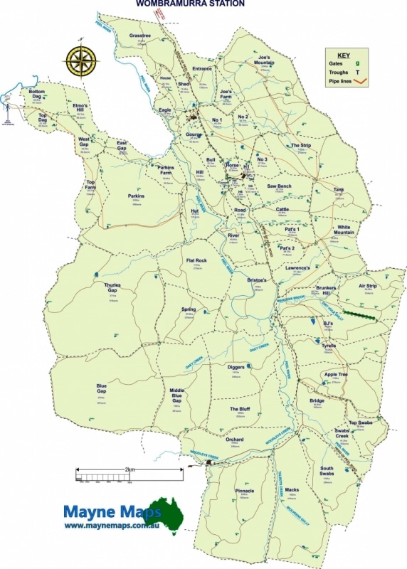
A Small Sheep Station Map
A sheep station map showing the fences, paddocks, paddock names, gates, contours and even the strainer posts.
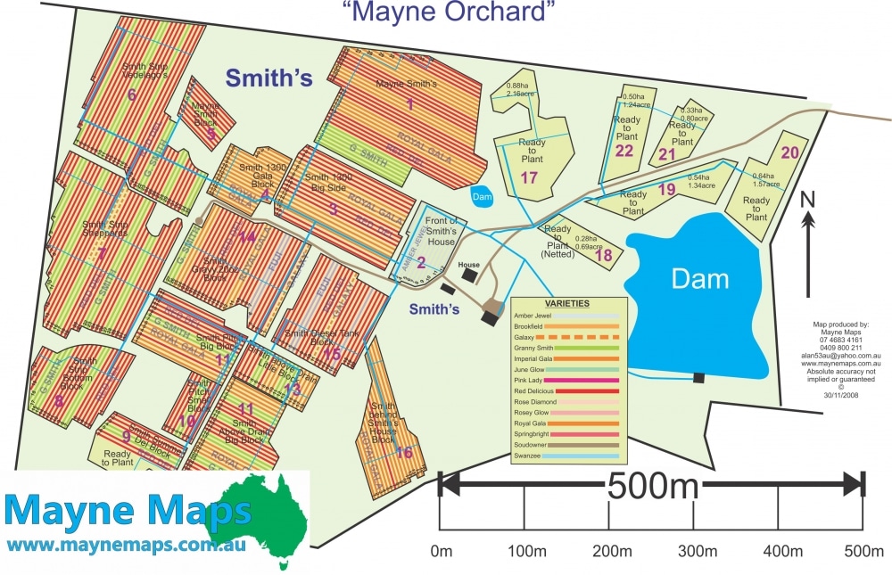
An Orchard Map
This is actually a macadamia farm map but could easilybe an olive farm map.
An Orchard Map
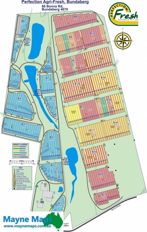
A lavlender farm map could be displayed exactly the same as this macadamia orchard map in Bundaberg.
Another Pineapple Farm Map
This pineapple Farm Map is near Bundaberg in Queensland.
Another Tasmania Apple Orchard Map
Apple Orchard Map in Tasmania
Apple orchard for sale
This apple orchard in Tasmania asked for this map to assist in selling the property
Apple Orchard Map
This Apple Orchard is one of many on the Granite Belt near Stanthorpe in Queensland
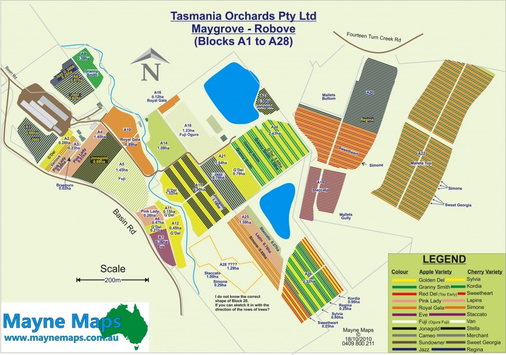
Apple Orchard Map in Tasmania
Every row of apples is colour-coded, numbered and labelled.
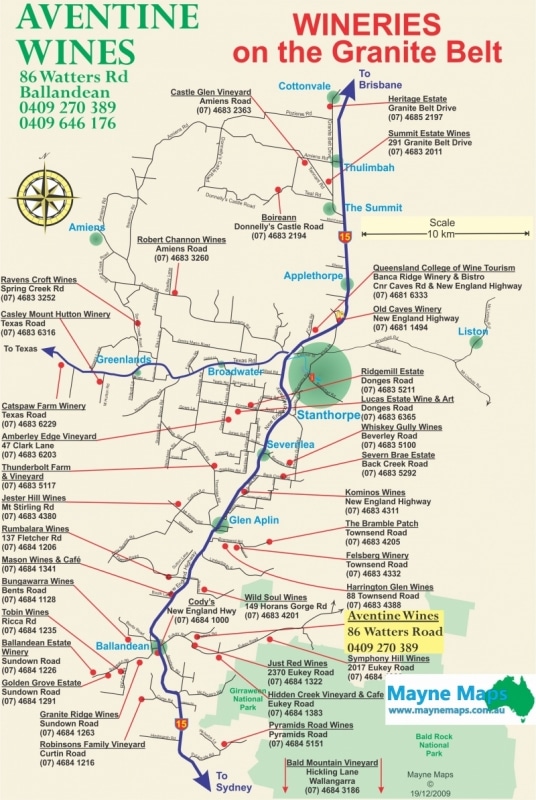
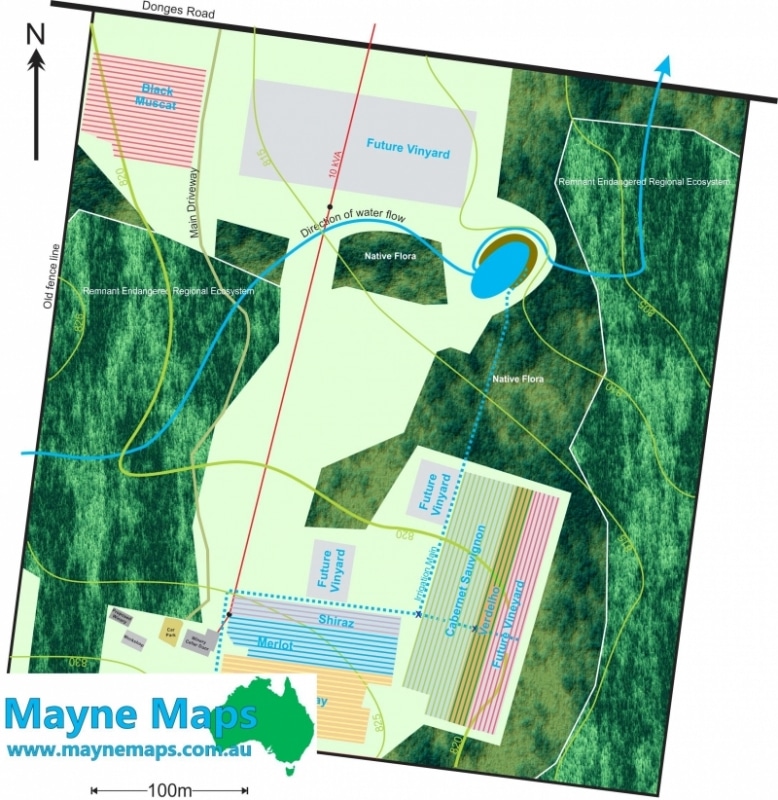
Aventine Wines Map
Aventine Wines on the Granite Belt believes that if they advertise other wineries, then more people will visit because of this Tourist Map.
Ballandean Village
A subdivision map at Ballandean on the Granite Belt
Beaudesert Horse Racing Stables
Beaudesert horse training map or a horse training facility.
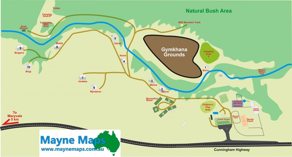
Bestbrook Map
Bestbrook near Cunninghams Gap has horse and trail bike riding, accommodation, a restaurant and a function room.
Blueberry Farm Map
A Blueberry Orchard near Bundaberg in Queensland.
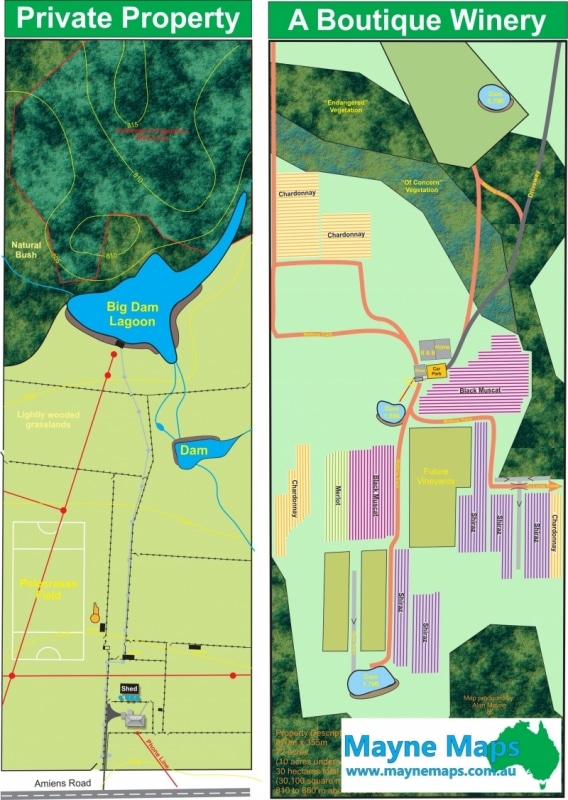
Boutique Winery Map
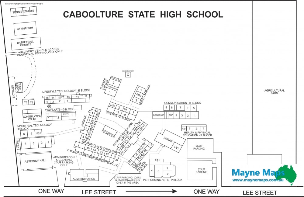
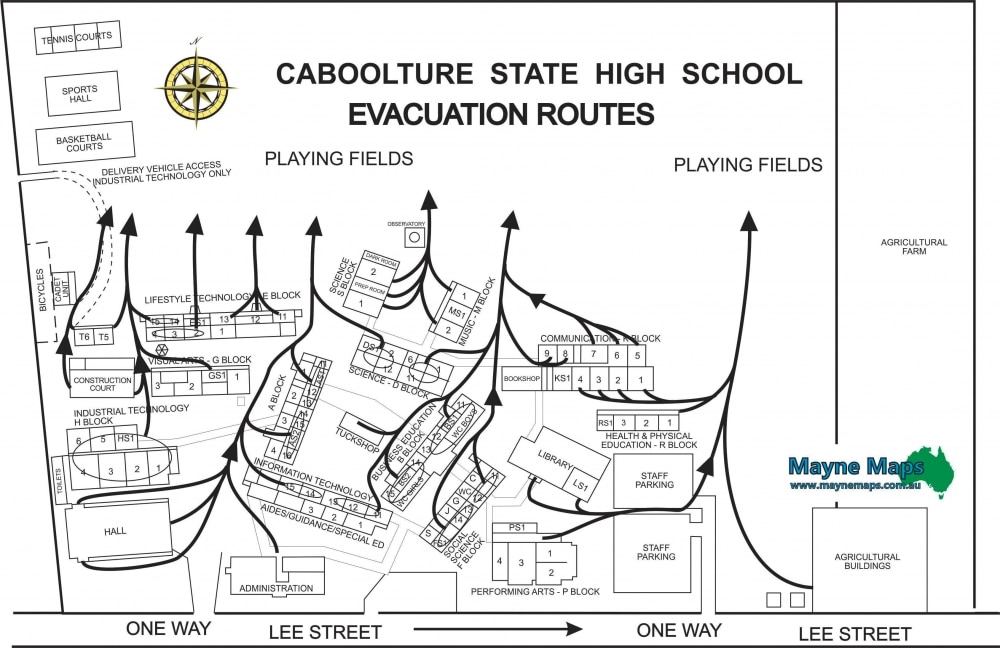
Caboolture State High
My first attempt at a map almost 20 years ago.
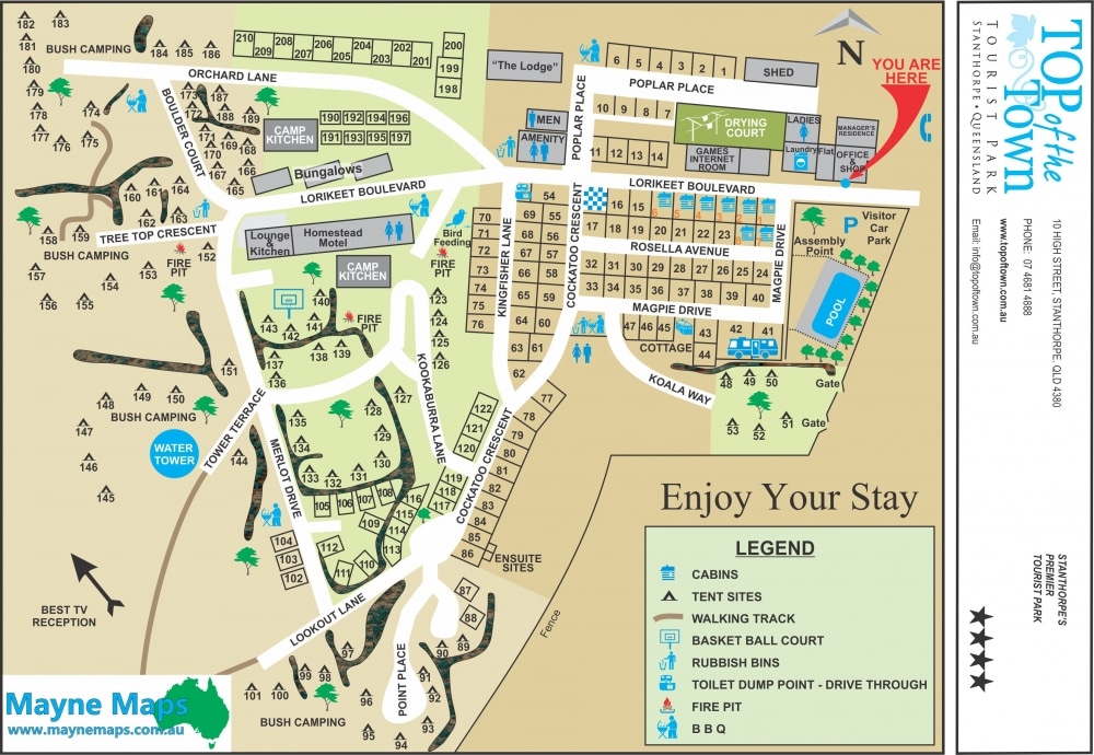
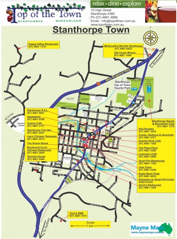
Caravan Park Map
The Top of the Town Caravan Park Map in Stanthorpe.
Cattle or Sheep Property Map
A small sheep station map or cattle property map near Stanthorpe.
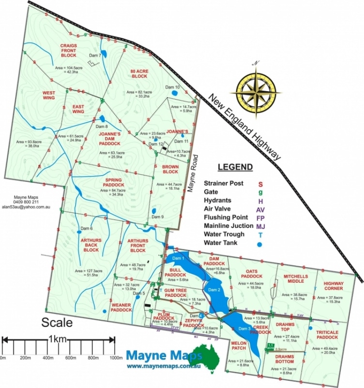
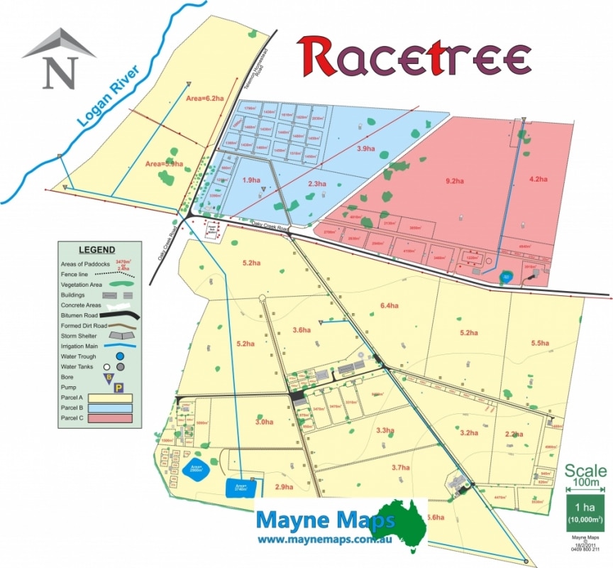
Cattle Property Map
Quite a large cattle property map of a property in the Hunter Valley.
Cattle Property Map
A cattle property map showing the fences, paddocks, paddock names, gates, contours and even the strainer posts.
Cattle Property Map on Aerial
The same property map using an aerial image as background
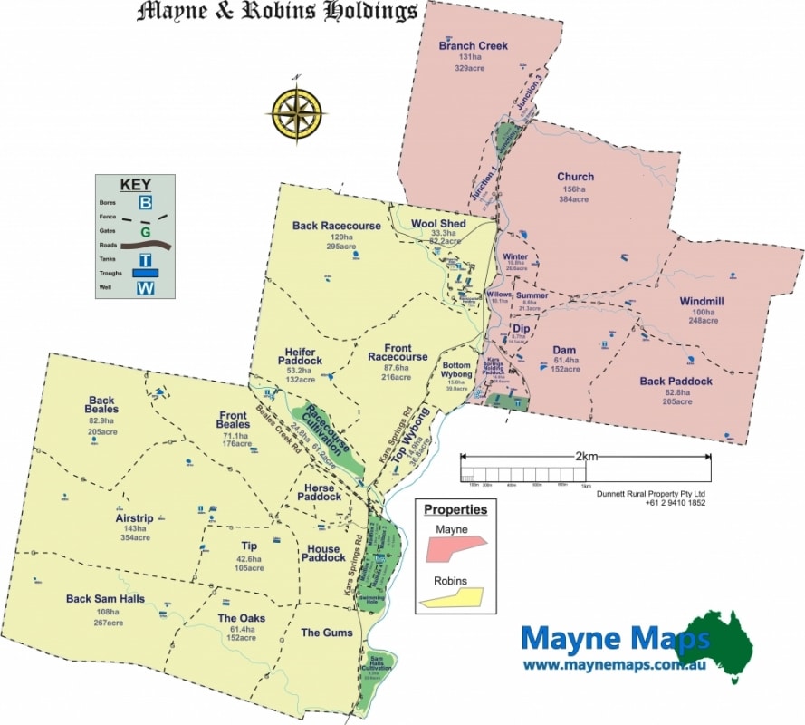
Charming Property Maps
These two properties look great with maps like these.
Citrus Orchard Map
A Citrus Orchard near Mundubbera.
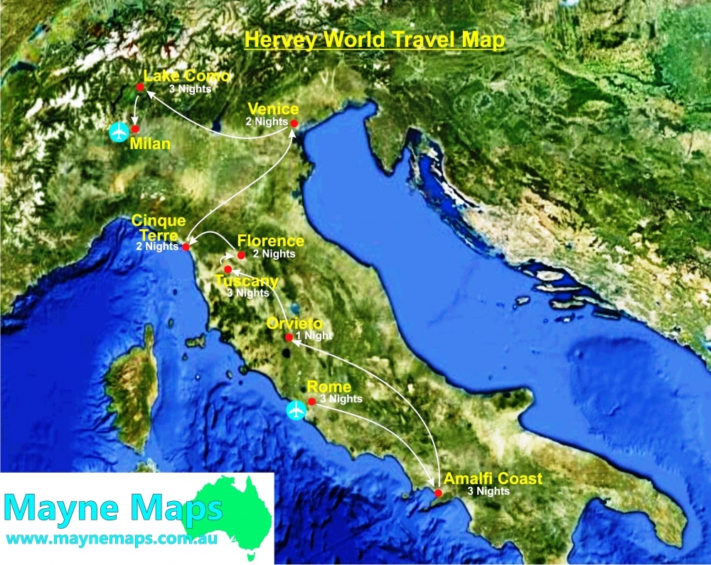
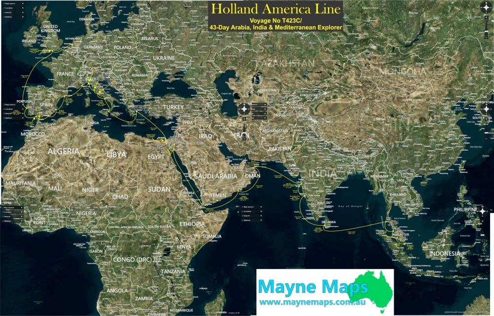
Cruise Map
Ship cruise map for Hervey World Travel.
Detail of Citrus Farm Map
Part of a citrus orchard map showing thedetail required by the owner.
Detail of Pineapple Farm
Small part of Pineapple Farm Map showing the detail requestedby the owner – even the contour lines.
Detail of Small Crops Map
A small part of a Small Crops Map showing the detail required by management.
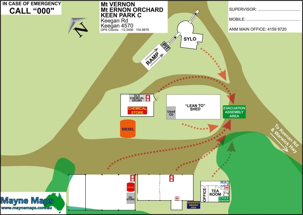
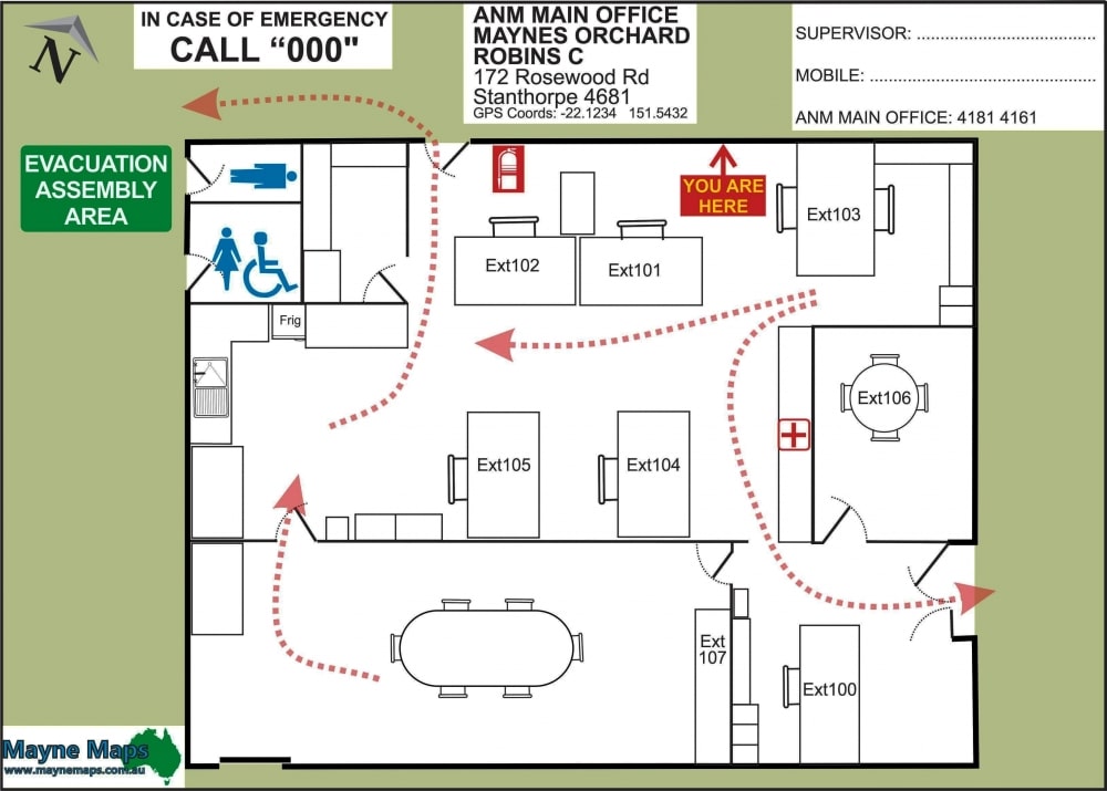
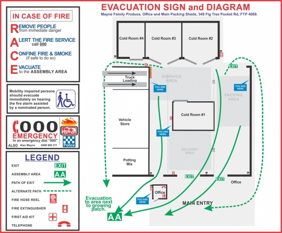
Evacuation Maps
An emergency map for the workshop area for a farm.
Fence Length Map
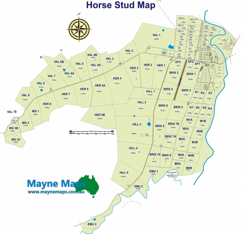
This horse stud map shows the length of each fence as well as the total length of fencing. They have over 300km of fencing.
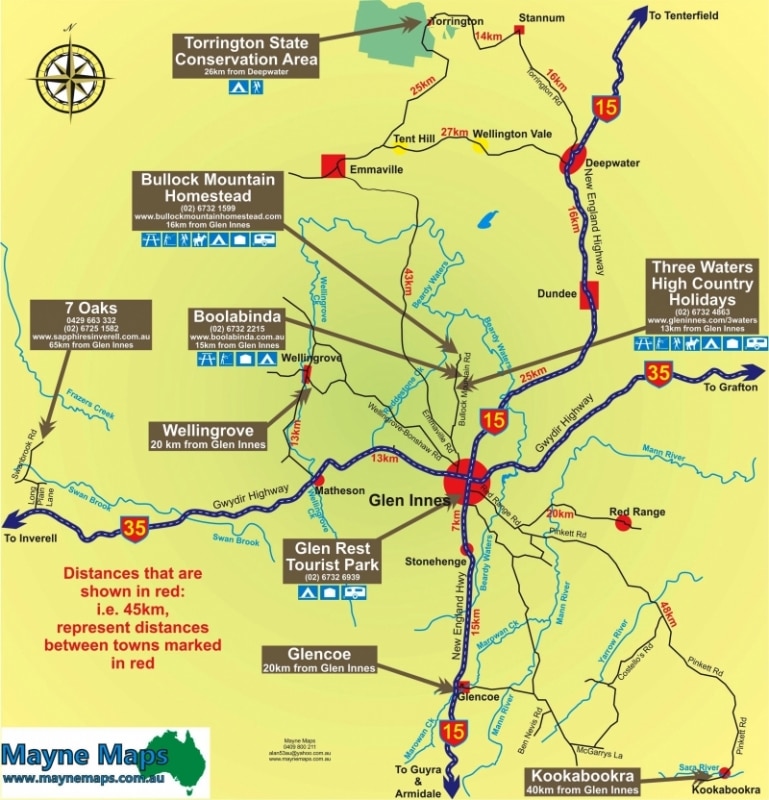
Glen Innes Map
A map produced for the Glenn Innes Fossickers society.
Glen Innes Showground
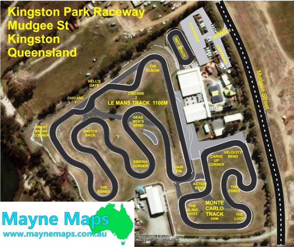
Go Kart Track Map
Kingston Park Raceway Go Kart Track Map
Grazing Property Map
A grazing property map that has sheep and cattle as well as crops.
Grazing Property Map
Cattle Property Map or Sheep Station Map.
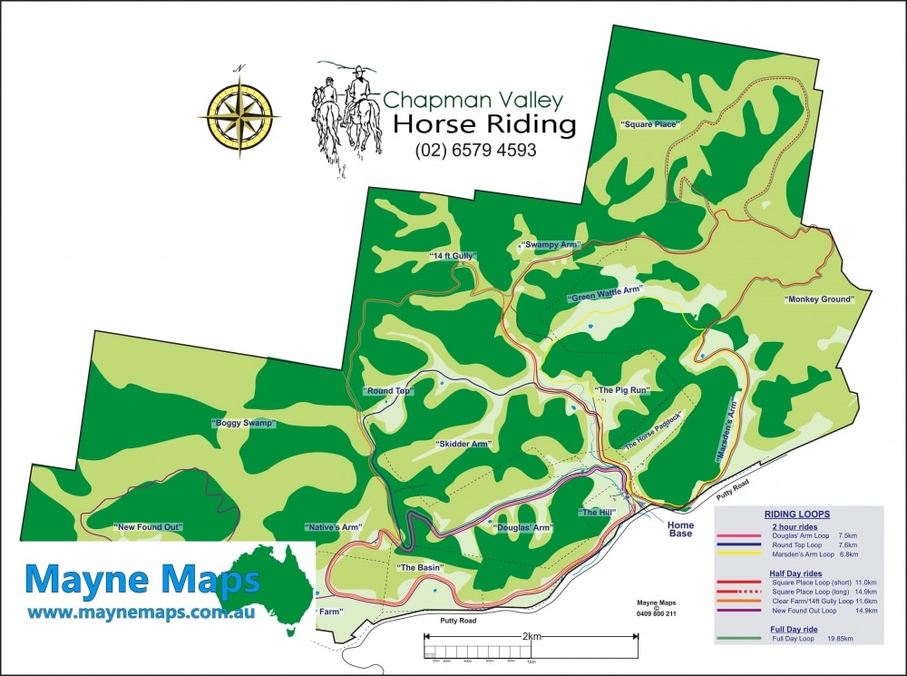
Horse Riding Map
Chapman Valley Horse Riding School Map in the Hunter Valley.
Horse Stud Map
A horse stud map in the Hunter Valley
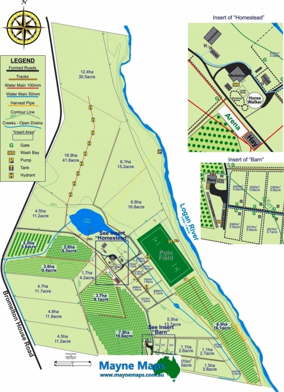
Horse Stud Map with Inserts
A Horse Stud Map with inserts showing the detail of the yards and buildings.
Horse Training Property Map
Mayne Maps were asked to produce the Horse Training Map to help sell the property.
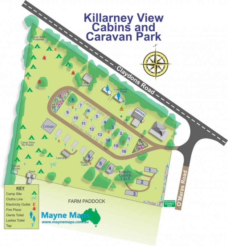
Killarney Holiday Park
A small Caravan or Holdiday Park in Country Queensland.
Large Apple Orchard Map
A large Apple Orchard Map near Stanthorpe
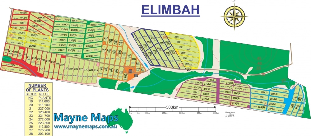
Large Grazing Property Map
Quite a large Sheep Station Map or Cattle Station Map
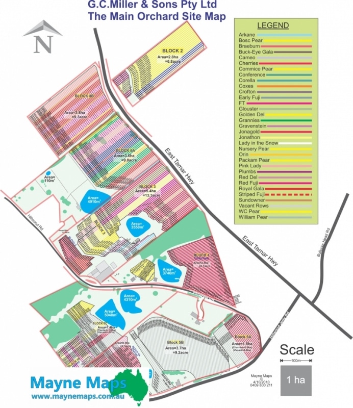
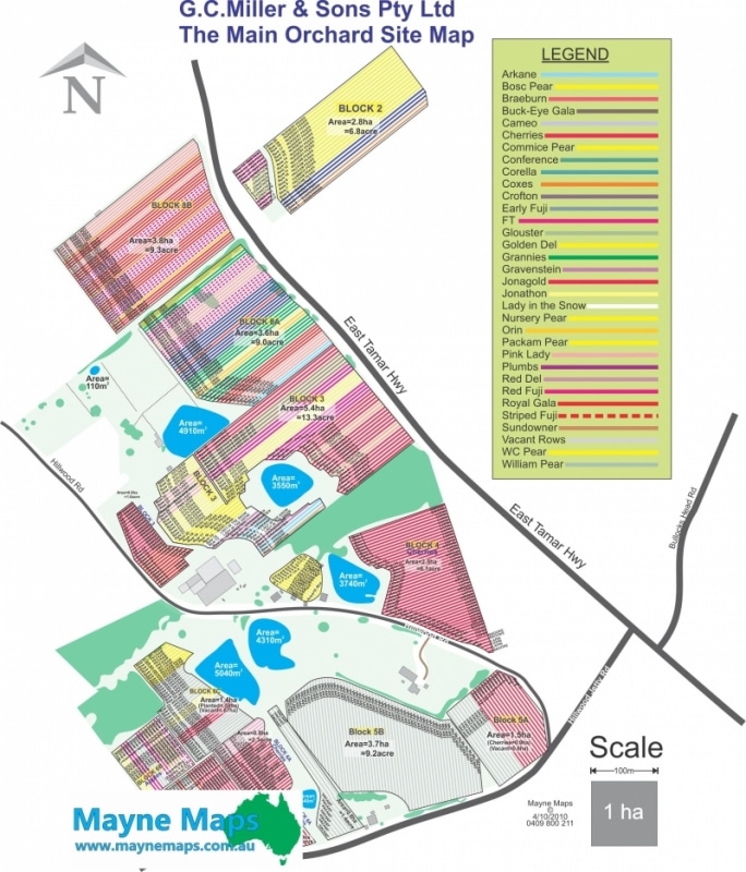
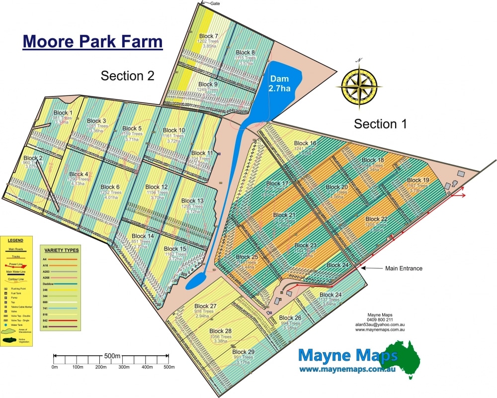
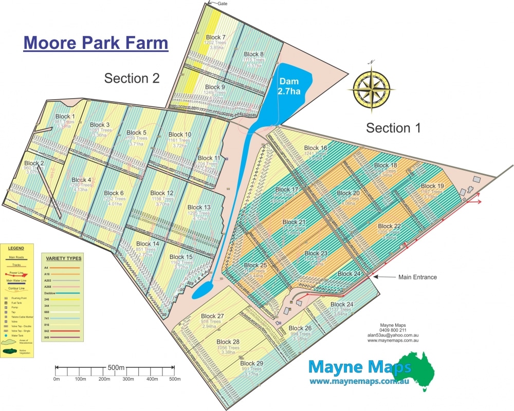
Large Orchard Map
This Laverder Orchard Map is really a macadamia farm map but could just as easily been a lavender farm map.
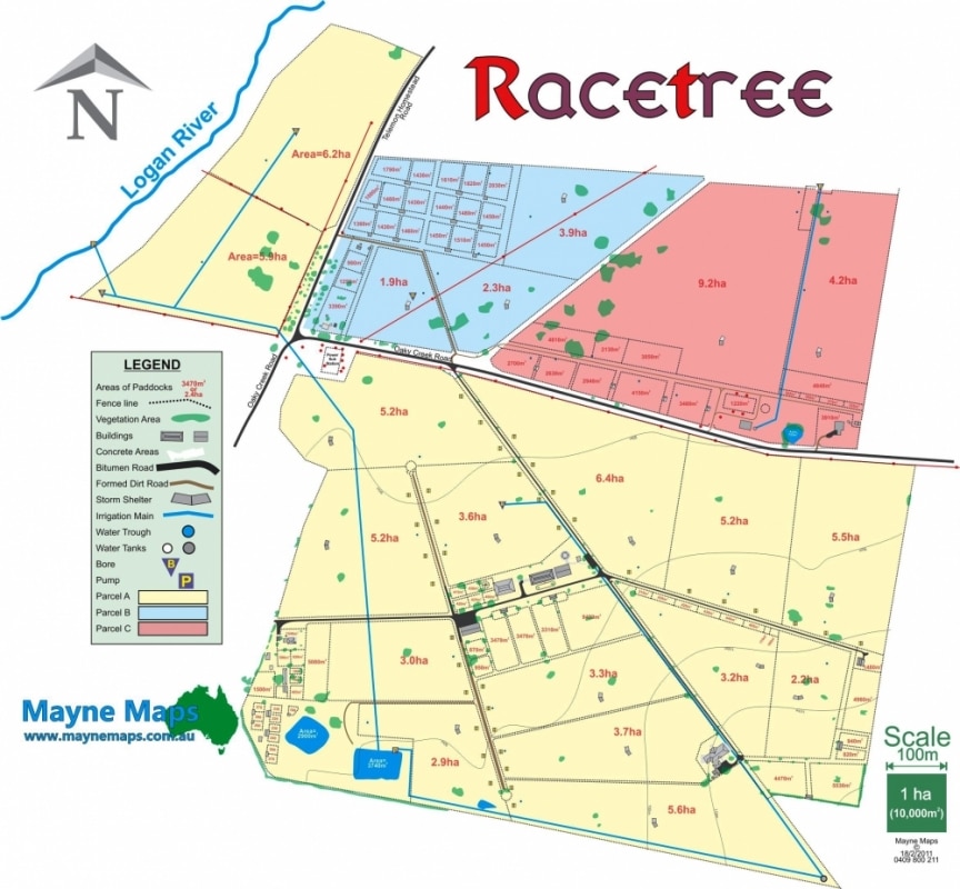
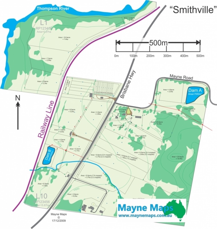
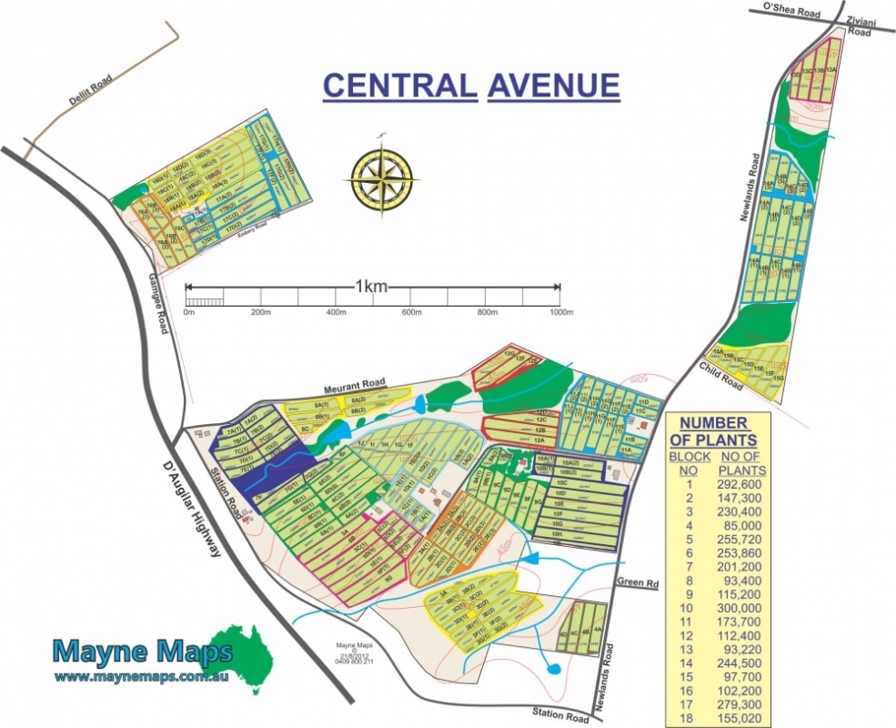
Large Property Map
A large cattle property map near Emerald in central Queensland.
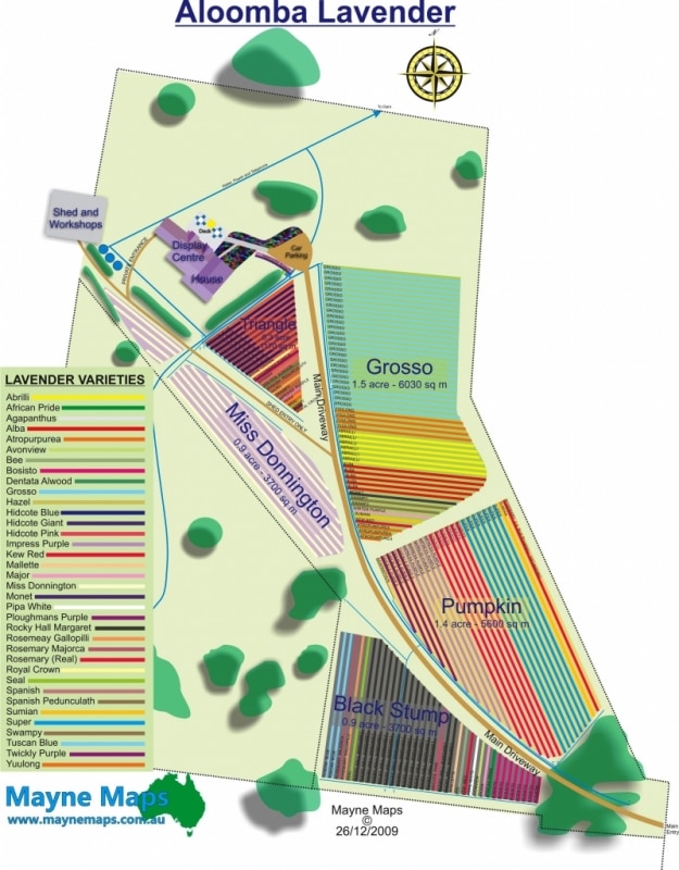
Lavander Orchard Map
This Lavender Orchard Map displays Aloomba Lavander which is near Liston in New South Wales. Aloomba Lavander is a tourist attraction with accommodation.
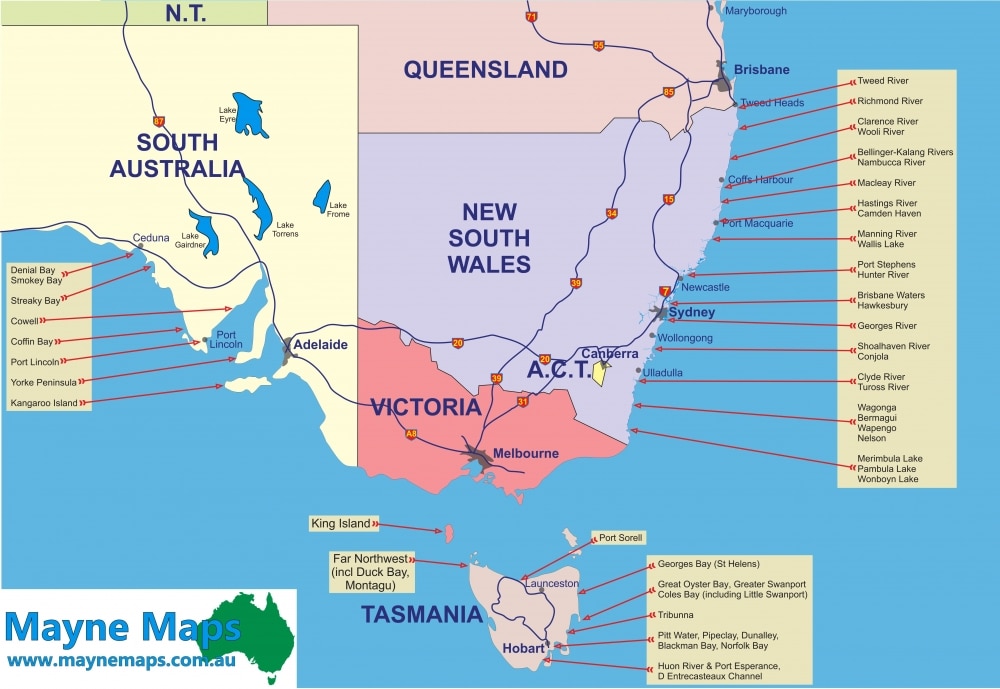
Location Map for Australia
A Locator Map such as this can be invaluable for Business.
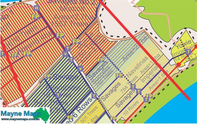
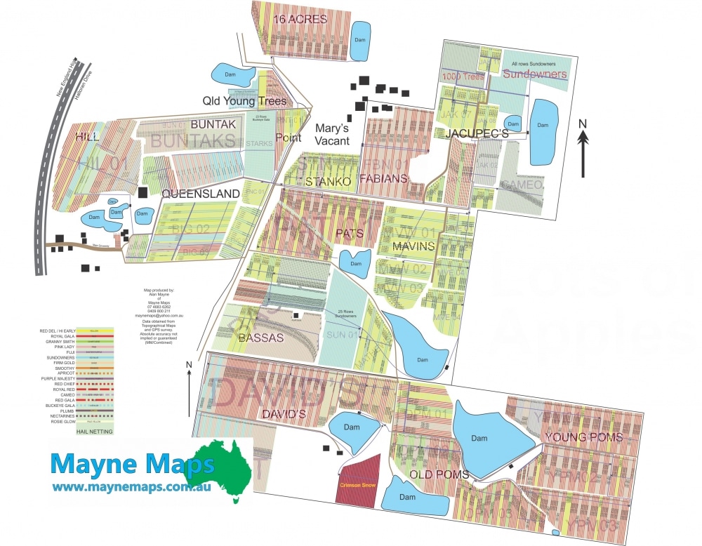
Macadamia farm map
A small part of the macadamia orchard map showing more of the detail required by management.
Map of Pineapple Farm
This pineapple Farm Map is in Wamuran near Caboolture in Queensland.
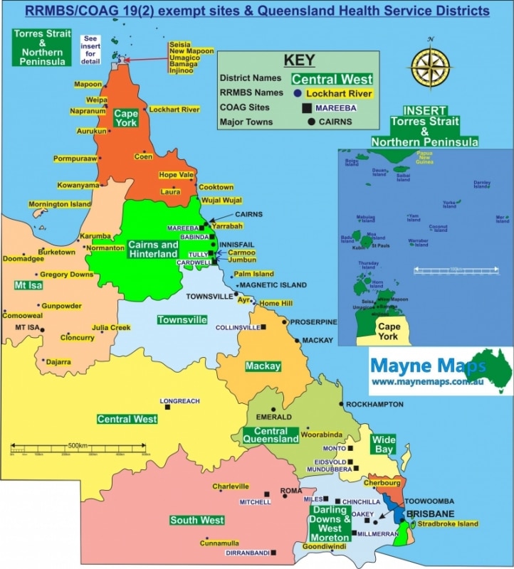
Map of Queensland
A Queensland Health Map
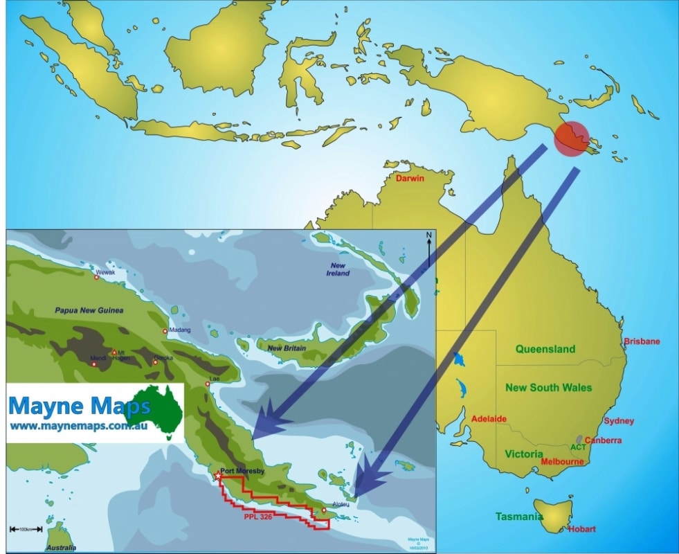
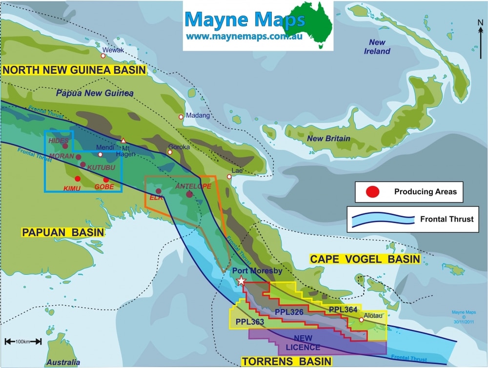
Mineral Exploration Map
A mineral exploration map in New Guinea.
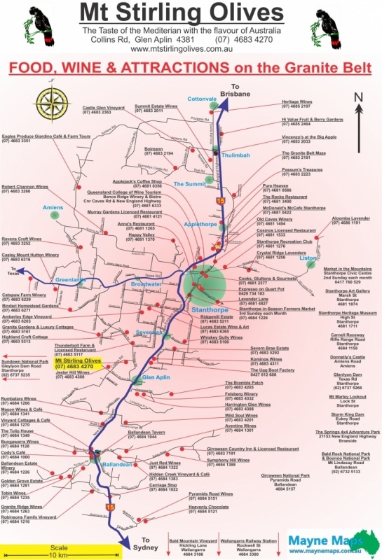
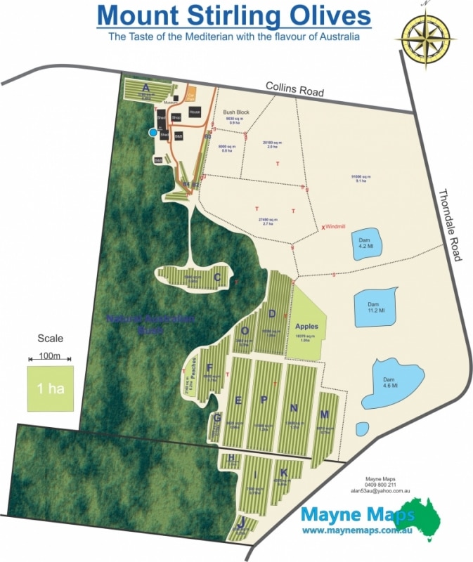
Mount Stirling Olives
This Tourist Map is used by Mt Stirling Olives on the Granite Belt.
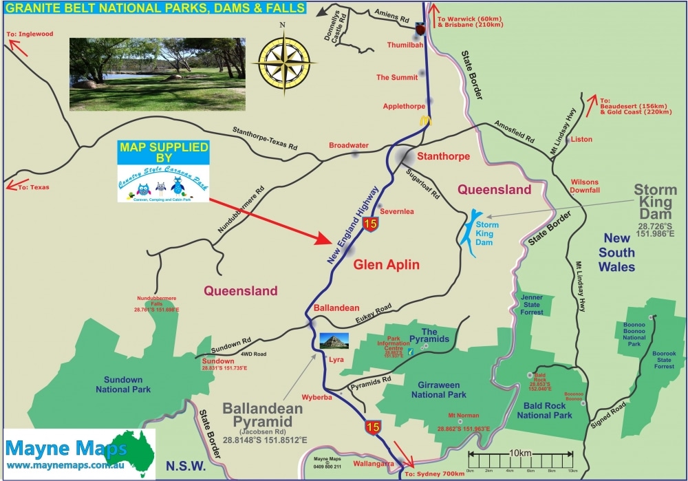
National Parks Map Locator
This National Parks Locator Map is used to show visitorsto the Granite Belt the location of the numerous National Parks.
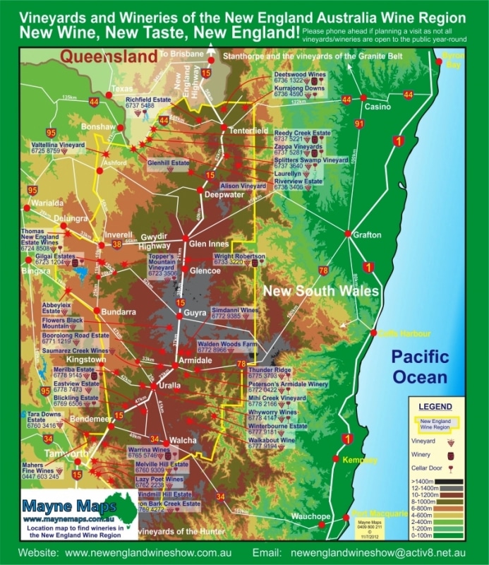
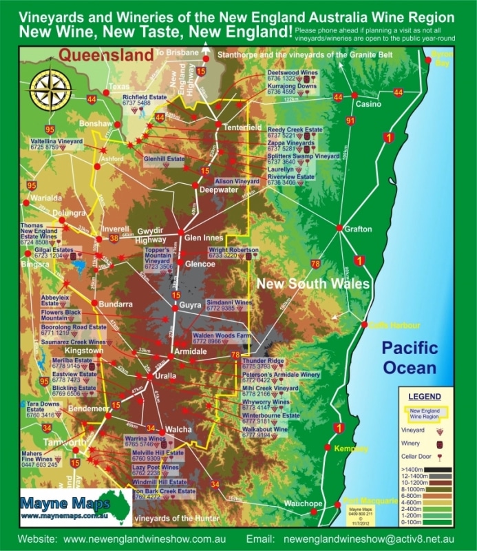
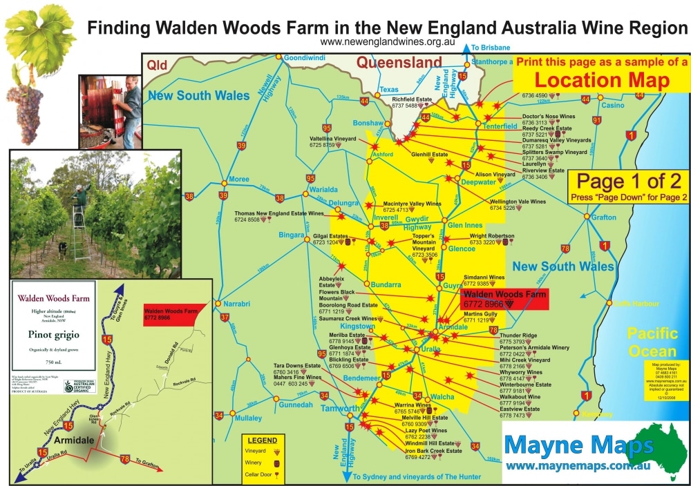
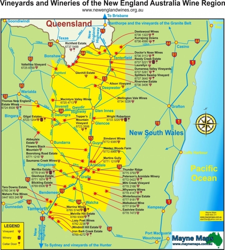
New England Wine Map
Location map to locate wineries in the New England Wine region.
New England Wine Region
The New England Wine Society distributes this Tourist Map at shows and displays to thousands of potential visitors. This map also serves as a contour map to show the elevation of the vineyards.
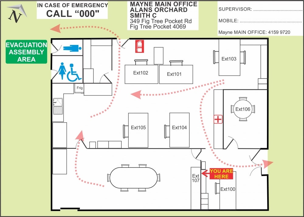
Office Evacuation Map
A Farm Office Evacuation Map or a Work Place Emergency Evacuation Map
Oil Exploration Map
Oil Exploration Map for a mining company in New Guinea.
Olive Orchard Map
Map of Mount Stirling Olives on the Granite Belt. A lovely tourist attraction as well as an olive farm.
Orchard Farm Map
This is also a macadamia farm map but could easilybe an olive orchard map.
Part of a Vegetable Farm Map
A small part of the Vegetable Farm Map.
Pinapple Farm Location Map
Farm location map of a Pineapple Farm near Caboolture in Queensland, Australia
Pineapple Farm Map
This pineapple Farm Map is near Caboolture in Queensland. As well as the map, this image contains details on stock numbers.
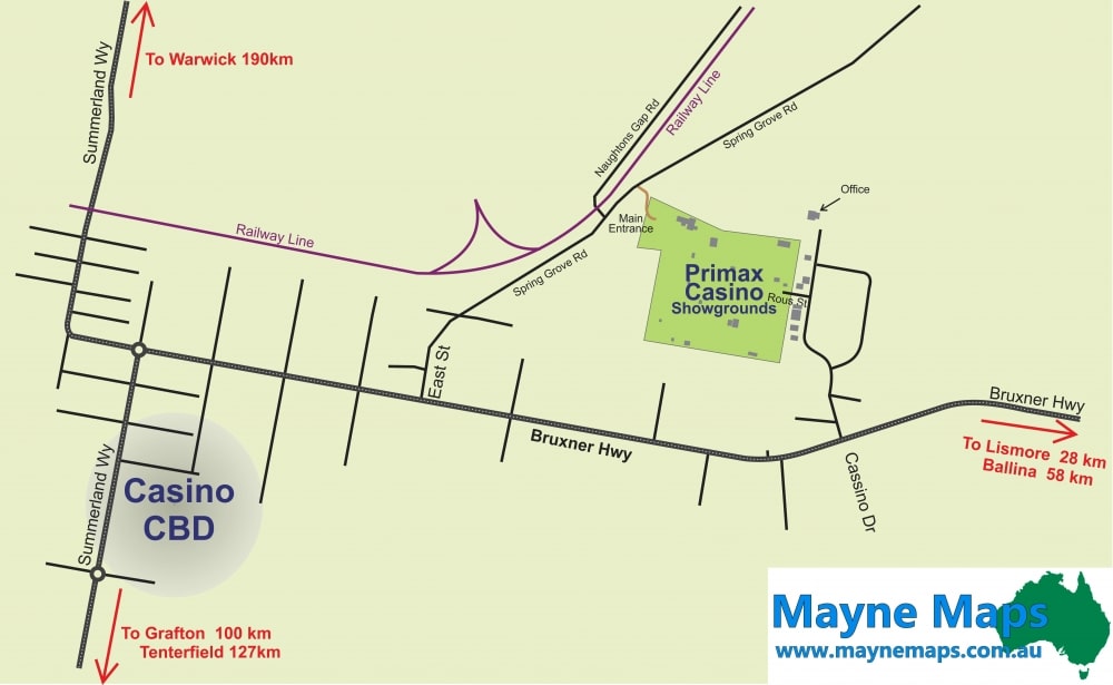
Primex Casino Map
The Primex Casino Show can be hard to findif you do not know where it is.
Real Estate Mapping Services
This Horse Stud Map was successful in helping to sell the property near Beaudesert in Queensland.
School Emergency Map
My first map of Caboolture High School became their first Emergency Evacuation Map or Work Place Health and Safety map.
Ships cruise map
Showground Location Map
This Primex Casino Showgrounds Map helps visitors find the Showgrounds.
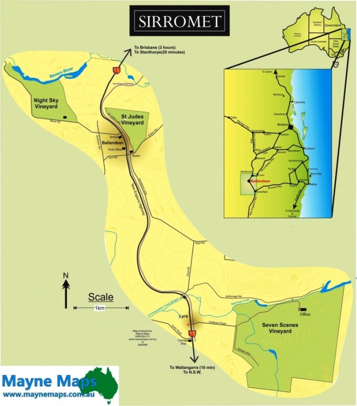
Sirromet Vineyard Locator Map
Sirromet Wines have a number of Vineyards on the Granite Belt. This Locator Map locates them.
Small Cattle Property Map
A small cattle property map near Stanthorpe.
Small Crops Farm Map
A Large Small Crops Farm Map on the Granite Belt.
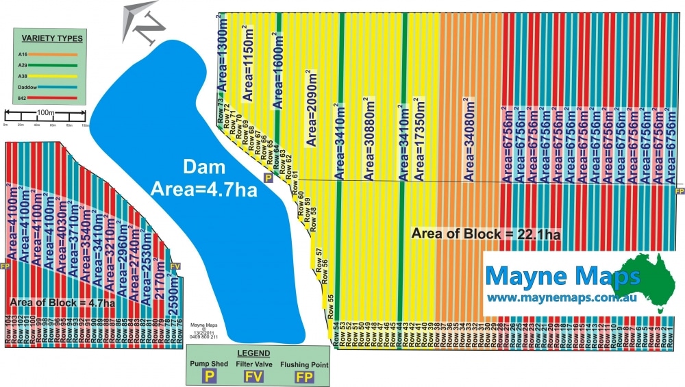
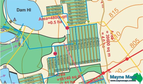
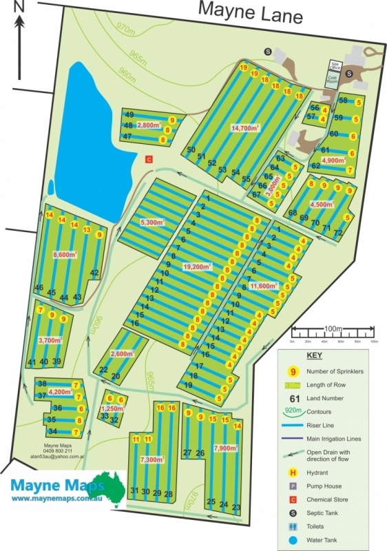
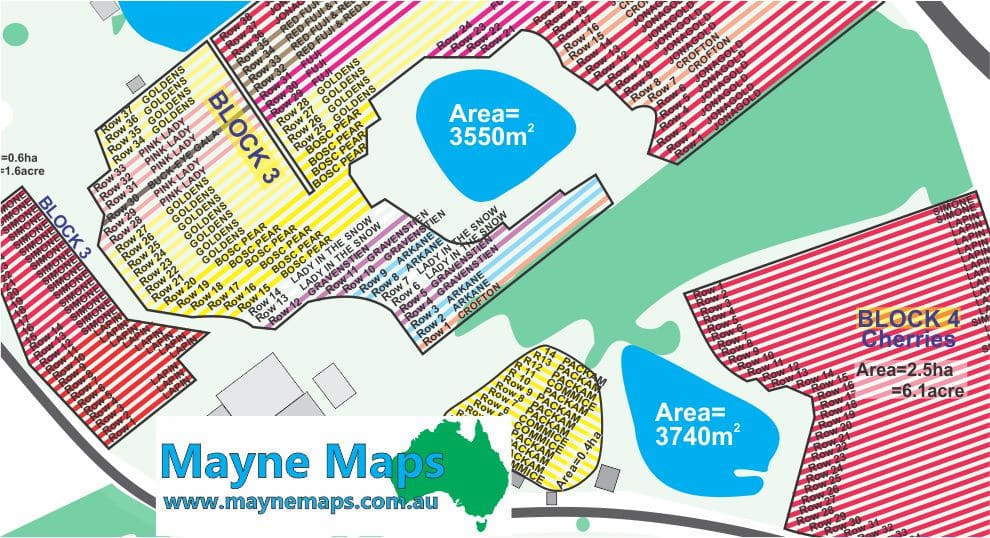
Small Crops Map
This Small Crops Map displays the lands as well as the areas of the lands,the rows numbers and the number of risers, in each row. Contours and the drains are also displayed.
Small Crops Map
This Small Crops Farm Map displays the lands as well as the areas of the lands,the rows numbers and the number of risers in each row. Also shown are the contours and the drains.
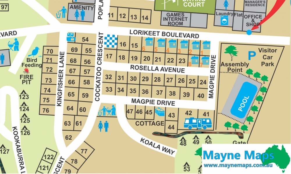
Small part of the Caravan Park Map
Part of the Top of the Town Caravan Park Map showing detail of the sites.
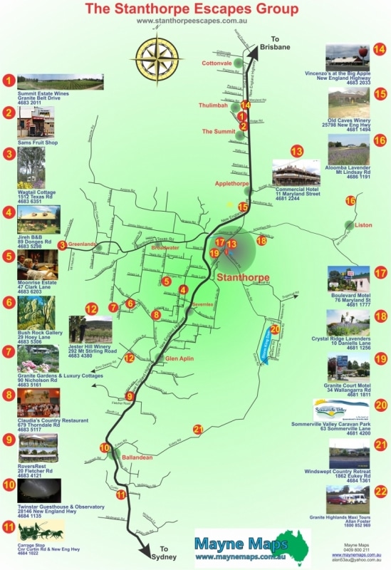
Stanthorpe Escapes Map
The Stanthorpe Escapes tourist group uses this map on their web site.
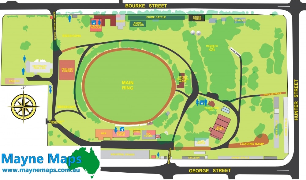
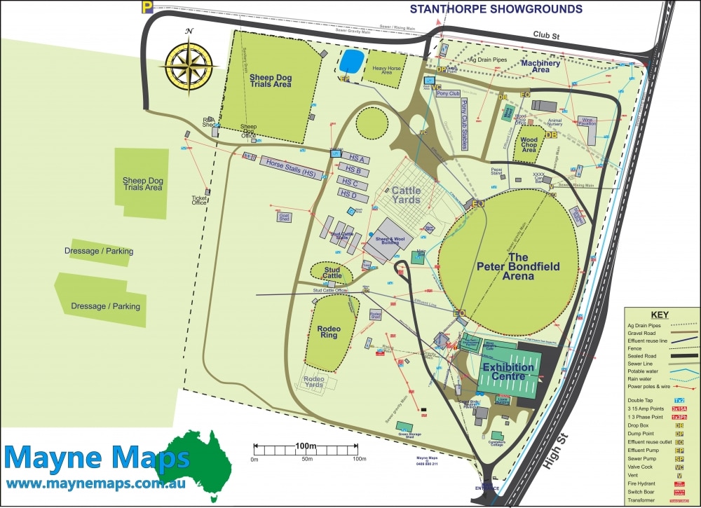
Stanthorpe Showground Map
If you look closely at this Showground Map you can also see all the underground features that are invaluable in managing the property.
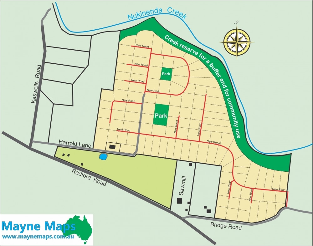
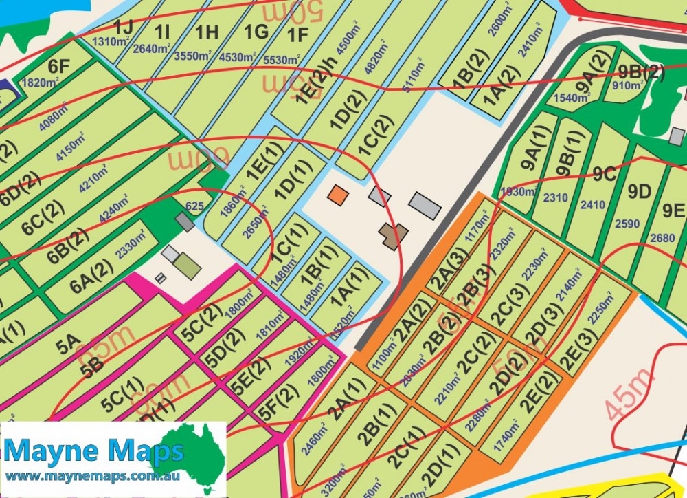
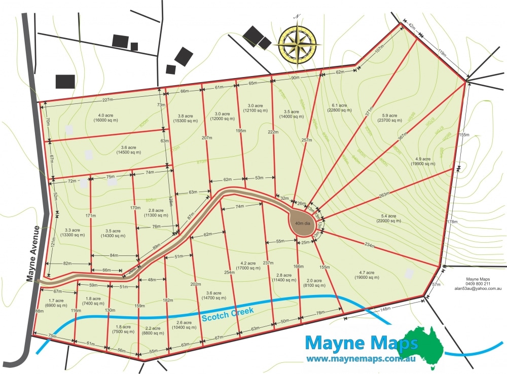
Subdivision Map
An initial draft of how a large block might be divided into smaller blocks.
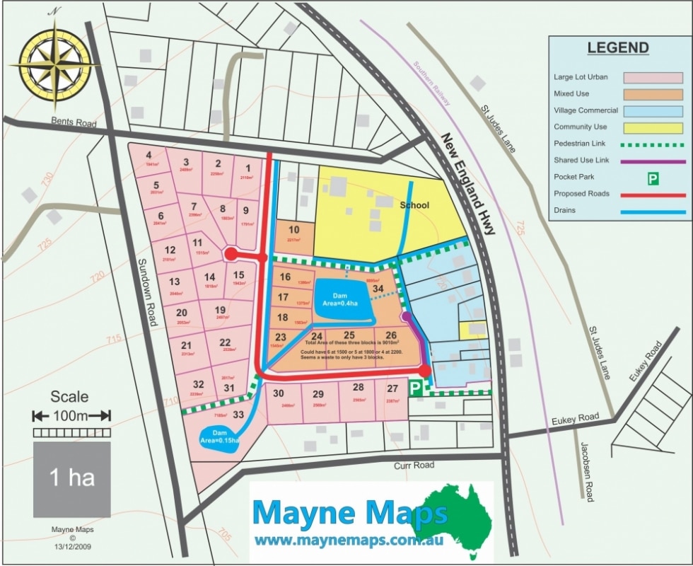
Subdivision Plan
A subdivision map that showed how a block of land might be subdivided
Subdivisions
A subdivision map displaying many features of the smaller lots including the contours as well as other features.
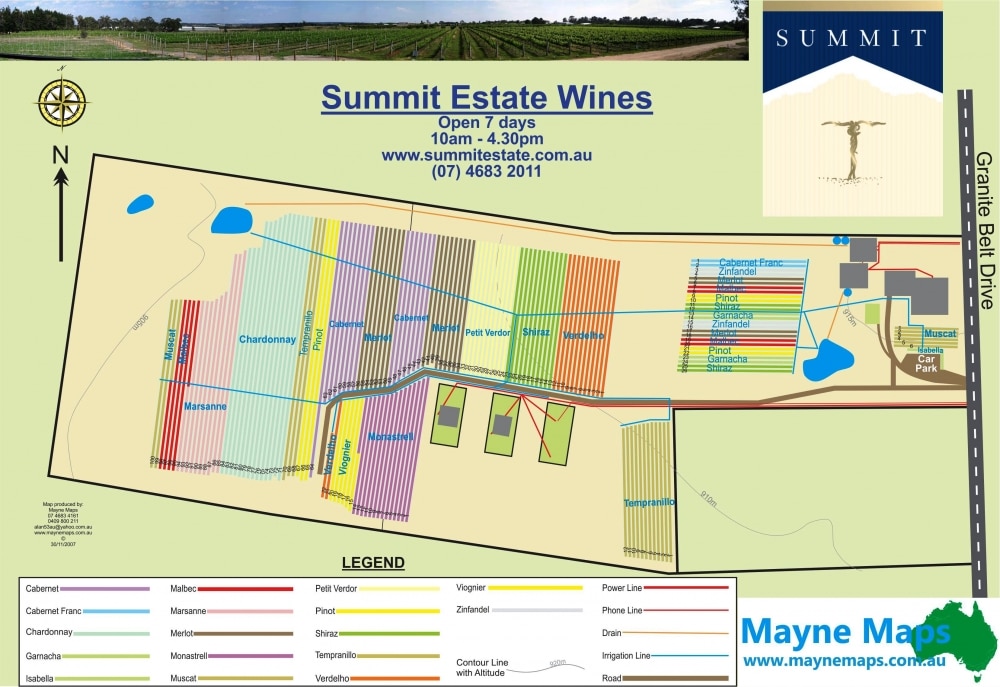
Summit Estate Wines
Summit Estate on the Grante Belt is one of the most popular boutique vineyards.
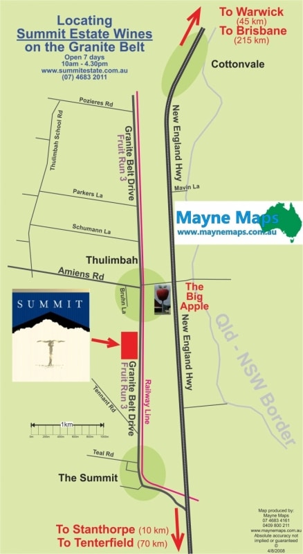
Summit Estate Wines Locator Map
Tourism Location Map to locate Summit Estate Wines on the Granite Belt.
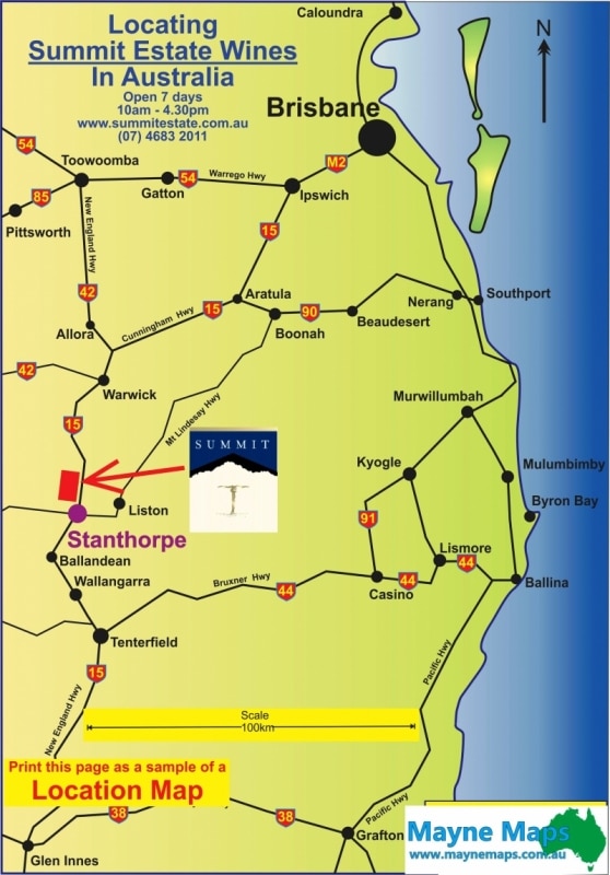
Summit Estate Wines Locator Map
Tourism Location Map to locate Summit Estate Wines in South East Queensland on the Granite Belt.
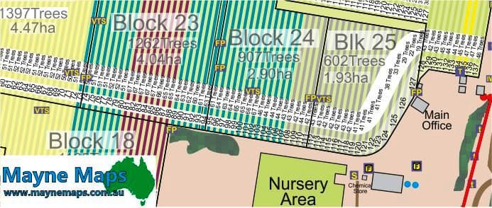
The detail of the Macadamia Orchard Map
Orchard Map showing even more of thedetail required by management.
The detail of the Orchard
The details of the orchard can now easily be seen.
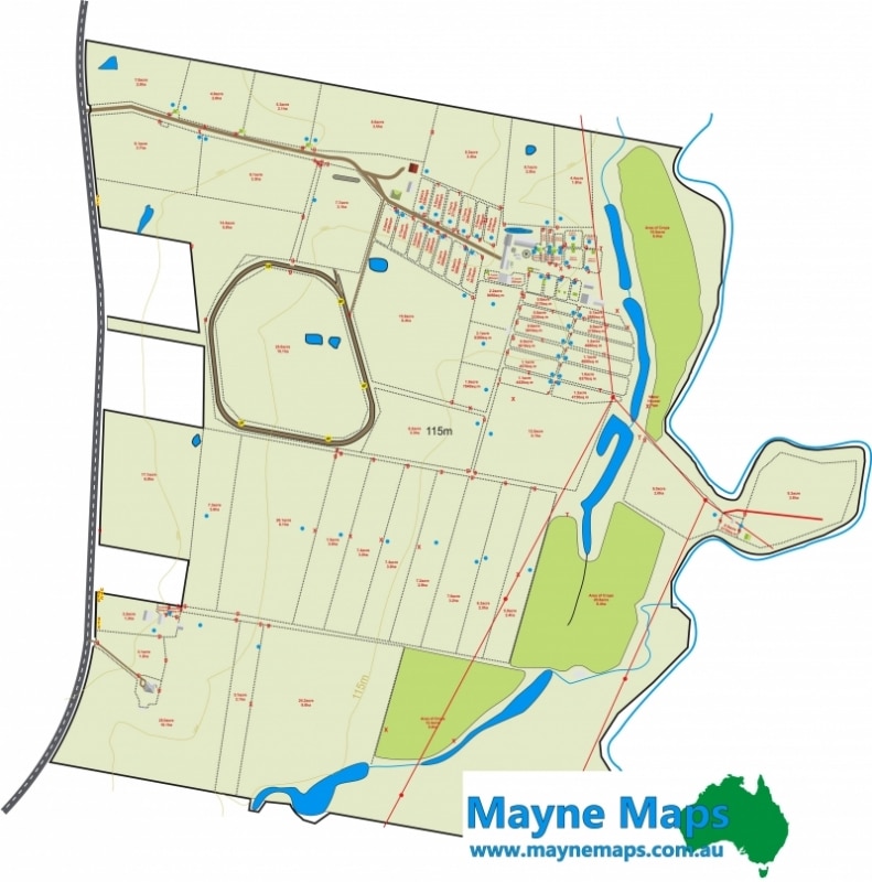
The detail of the Stud
Part of the horse stud map showing the fine detail required by management.
Top of the Town
The Top of Town Tourist Park gives out this map to show guests where to eat while they visit.
Tourist Venue Locator Map
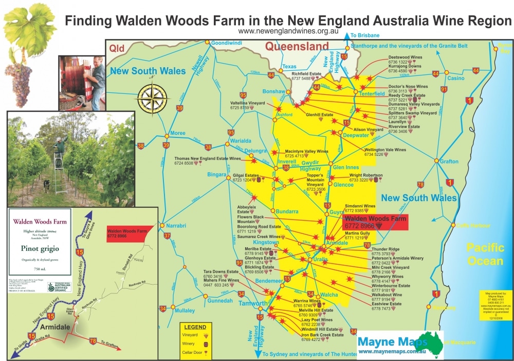
Walden Woods Location Map to find Walden WoodsFarm as part of the New England Wine region map.
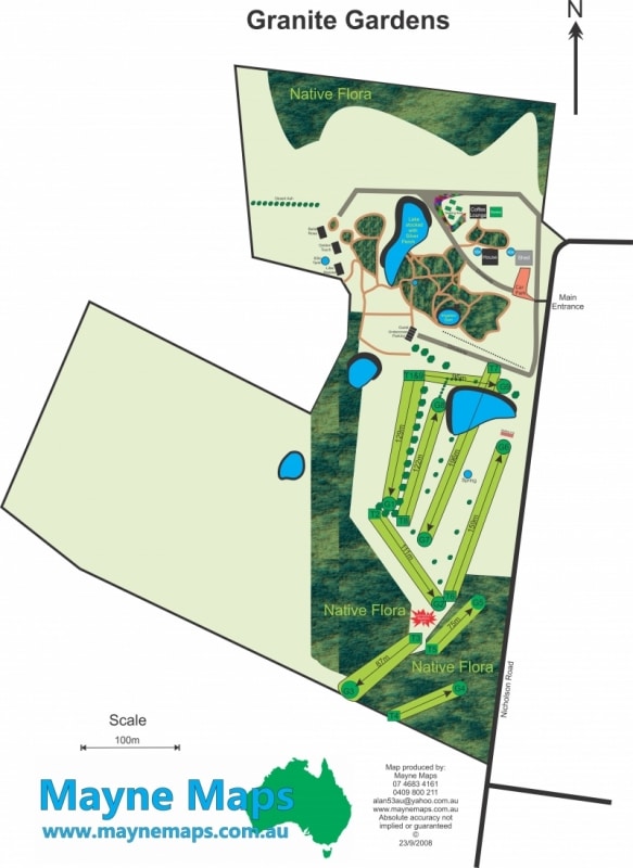
Tourist Venue Map
Granite Gardens near Stanthorpe on the Granite Belt has accommodation, gardens and a golf course
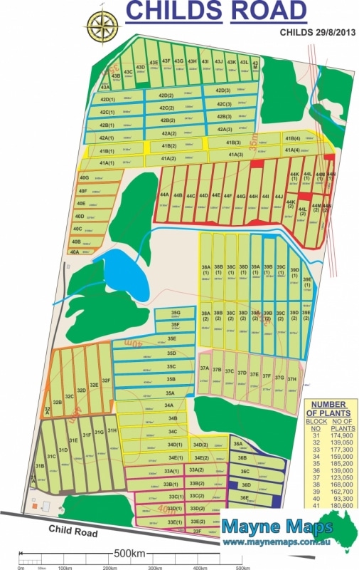
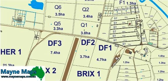
Vegetable Farm Map
A large Vegetable Farm Map on the Granite Belt.
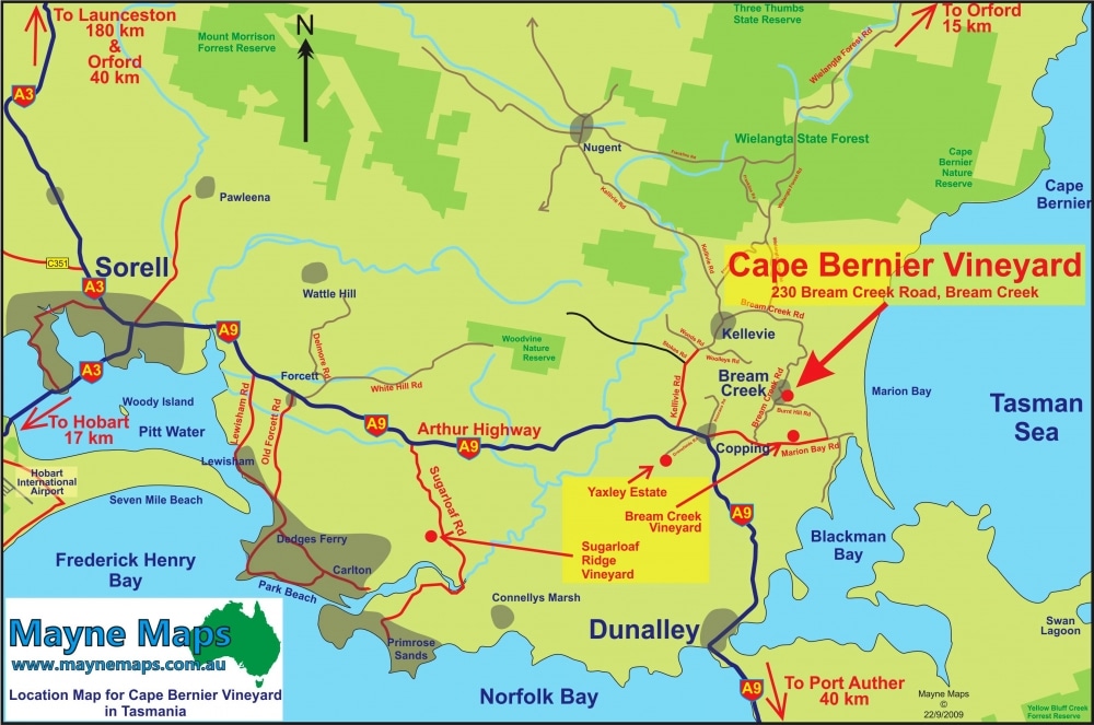
Venue Location Map
Cape Bernier Vineyard location map in Tasmania
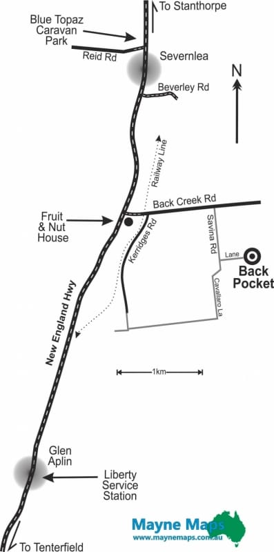
Vineyard Location Map
A simple Locator Map to find Back Pocket Vineyard near Stanthorpe on the Granite Belt.
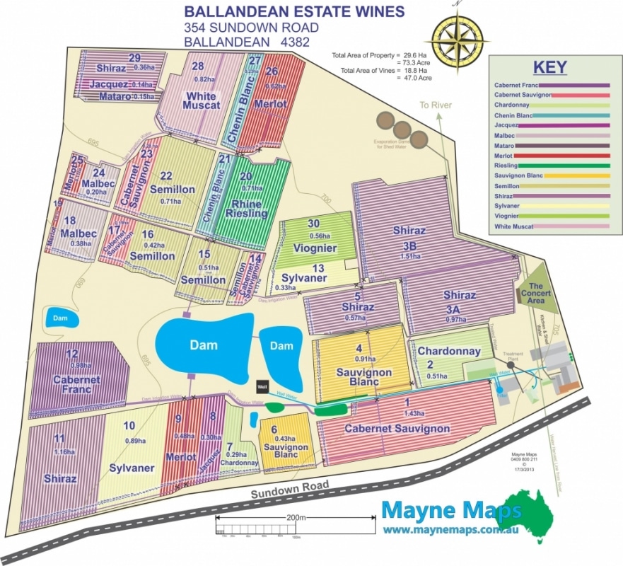
Vineyard Map
This winery map shows off one of the oldest and most established vineyards in Australia.
Walden Woods Farm
Walden Woods Vineyard uses this Tourist Map to show visiters how to find them and what else to do while in the district.
Warwick Tourism Location Map
This in an interactive Tourist Locator Map for the Warwick District Tourist area.
WHS Map for a Workshop
Essential map for a Workshop especially considering that many of the workers are “Backpackers” and would not know procedures to follow in an emergency.
WHS Map for an office
This office is on a farm property
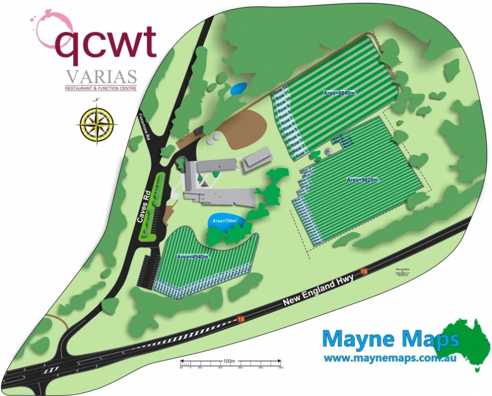
Wine College Map
Queensland College of Wine and Tourism
Wine Venue Map
The New England Wine Society distributes this Tourist Map at shows and displays to thousands of potential visitors.