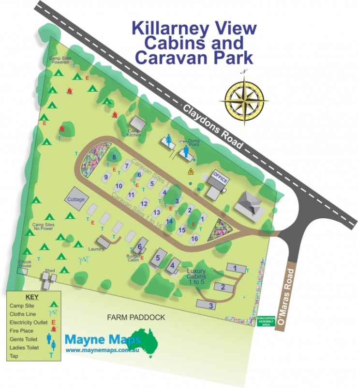
Killarney Holiday Park
A small Caravan or Holdiday Park in Country Queensland.
Cattle Property Map
A cattle property map showing the fences, paddocks, paddock names, gates, contours and even the strainer posts.
Small Cattle Property Map
A small cattle property map near Stanthorpe.
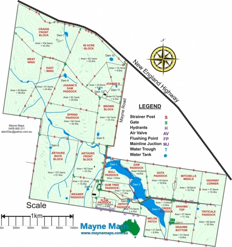
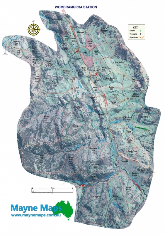
Quite a large cattle property map of a property in the Hunter Valley.
Cattle Property Map on Aerial
The same property map using an aerial image as background
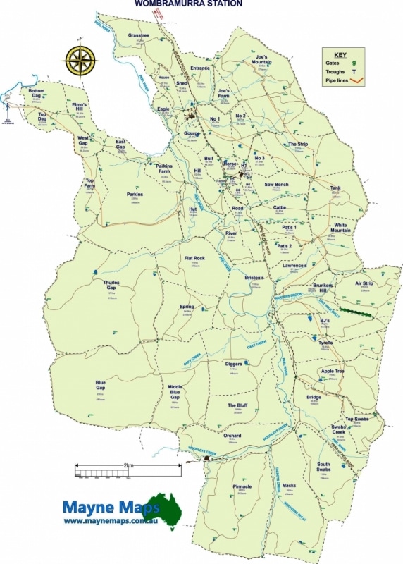
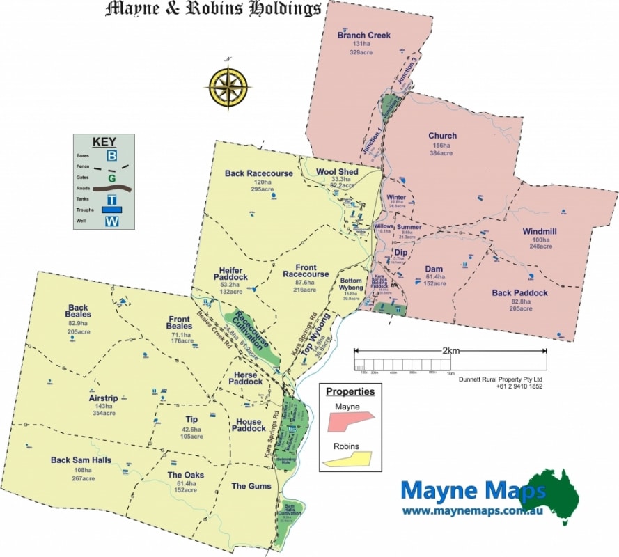
Large Property Map
A large cattle property map near Emerald in central Queensland.
Grazing Property Map
A grazing property map that has sheep and cattle as well as crops.
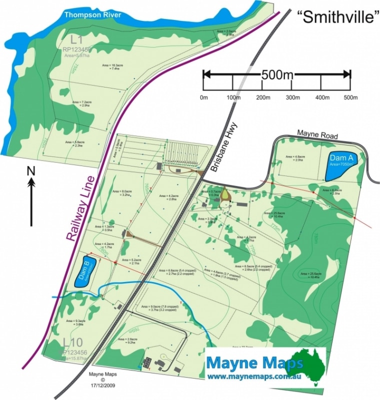
Citrus Orchard Map
A Citrus Orchard near Mundubbera.
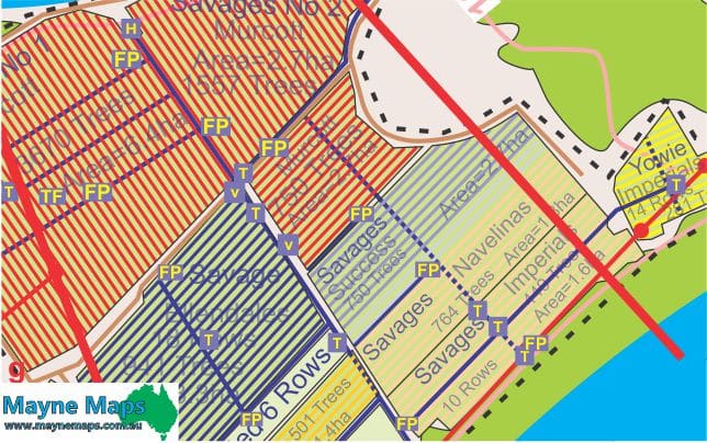
Detail of Citrus Farm Map
Part of a citrus orchard map showing thedetail required by the owner.
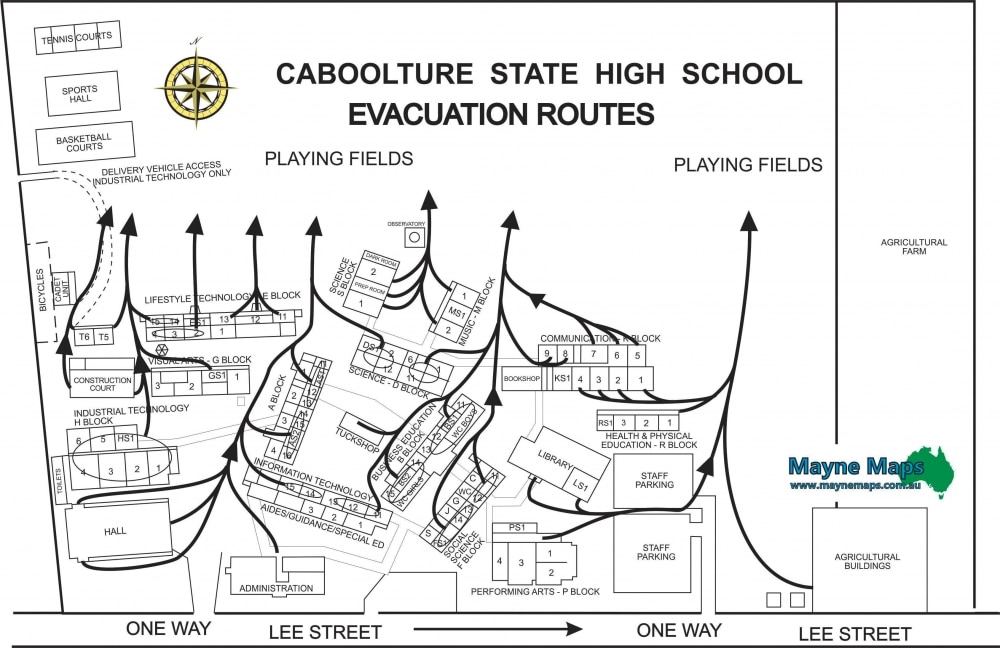
School Emergency Map
My first map of Caboolture High School became their first Emergency Evacuation Map or Work Place Health and Safety map.
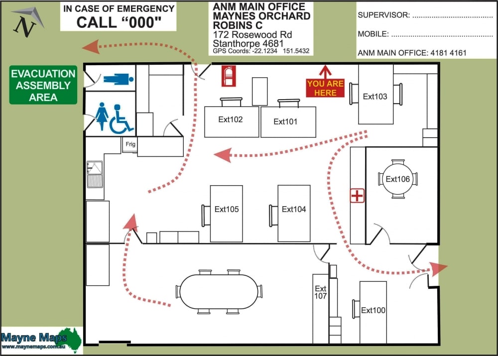
Office Evacuation Map
A Farm Office Evacuation Map or a Work Place Emergency Evacuation Map
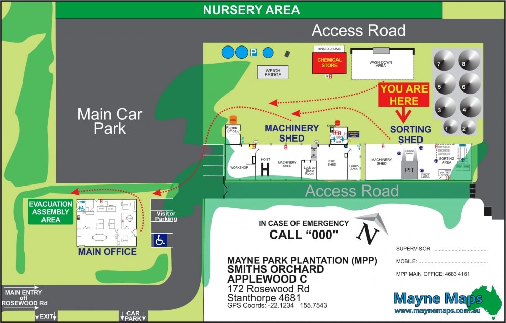
Work Place Health Map
A Work Place Health and Safety map to evacuate the workshops and buildings.